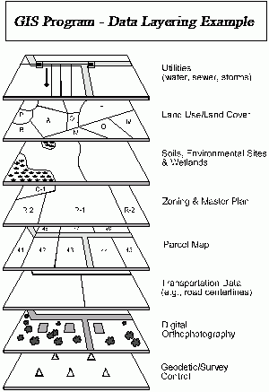

The Geographic Information System (GIS) and Mapping group at Fenton Township have the responsibility for gathering and managing geographic data. The GIS being developed by the Township is multi-departmental system composed of components used to collect, organize, analyze, visualize, and disseminate geographic information and maps. To date the Township's GIS has provided services for the departments of assessing, building, clerk, public safety, planning & zoning, sewer, as well as many residents within the Township.
"GIS is being used to share data, reduce redundant record keeping, and provide a powerful analytical tool to help staff make better and more informed decisions. GIS is an efficient way to communicate complex information by providing a visual concept of the data."
- Quote taken from our friends at Waterford Township
